Day 6 - Cirencester to Cricklade - 9.7 miles
The Roman road, the Ermin Way, runs south-east along the north side of the day's walking, crossing the flat alluvial plain created by the River Churn. When the water level is high, it might be worth checking in advance that the paths are passable. Surprisingly many of the buildings in the villages through which we pass are made of stone that was brought here from the Cotswold Hills. We follow the path beside canals and the Rivers Churn and Thames to arrive in the 9th Century Saxon town of Cricklade.
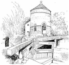
Lengthman's House, Cerney Wick
Day 7 - Cricklade to South Marston - 10.5 miles
The route continues in the low-lying river meadows of the RIvers Key and Ray which are tributaries of the River Thames to the north. It is part of the Upper Thames Environmentally Sensitive Area and is a remote, quiet place. Since the land can be water-logged when the water table is high, it may be advisable to walk in Wellington boots or to put them or a dry pair of socks in the rucksack! The route climbs to to the high point of Castle Hill from where there are fine views of the whole area.
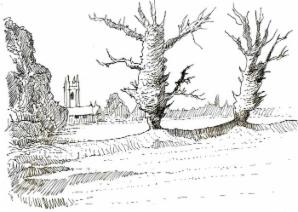
Saxon town walls, Cricklade
Day 8 - South Marston to Aldbourne - 11 miles
A day of crossing the valley of the River Cole passing the site of the Roman 'mansio' on the Ermin Way. There is a climb to the open Wiltshire downs before following a chalk valley down to Aldbourne. The route from South Marston to the Ermin Way is a complex network of footpaths, so extra time may be needed for this section.
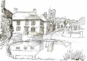
Village pond, Aldbourne
Day 9 - Aldbourne to East Garston - 9.3 miles
A day high on the chalk North Wessex downs, passing through a huge Iron Age hill fort. We cross from Wiltshire into Berkshire to meet and walk along part of the east/west route of the Roman Ermin Way. We then turn north over the watershed and down into the Lambourn Valley, where there is a fine Whistler window in Eastbury church.
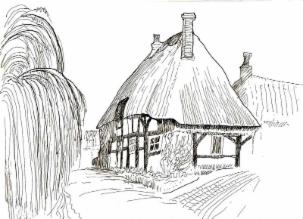
Thatched cottage beside the River Lambourn
Day 10 - East Garston to Donnington - 8.75 miles
In this section, we continue the south-easterly direction of Ermin Way, but much as the Anglo Saxons might have done to escape thieves on the Roman road, we follow the safety of the quiet settlements along the valley of the River Lambourn a few miles to the north. Most of the route follows the clear waters of the chalk stream, but ends by arriving at the strategic hill-top position of Donnington Castle.
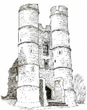
Donnington Castle
Day 11 - Donnington Castle to Woolhampton - 9.5 miles
From the low-lying land where Cromwell's troops were camped during the siege of Donnington Castle, we cross over the watershed from the valley of the River Lambourn into the valley of the River Kennet. We pass a Roman well in Speen, through the canal-side town of Newbury, then along quiet meadows. It was here that some of the richest finds from Mesolithic man were found. Then, there were wild pig and red deer; today this marshy land is inhabited with birdlife in the Thatcham reedbeds. East of Thatcham, the Ermin Way crosses the meandering River Kennet.
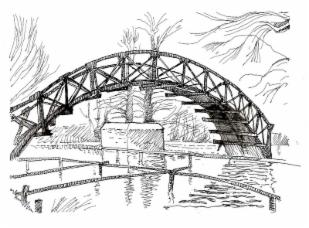
'Pillbox' beside bridge, Newbury